BEAMON Viewer: SOCIB launches a new APP monitoring Balearic Islands beaches in real-time
- This free and open web-based application provides real-time access to images and data from Cala Millor and Palma beaches (Mallorca), and Son Bou (Menorca).
Coastal ecosystems are increasingly threatened by climate change stressors such as rising seas or intensifying storms. Indeed, coastal ecosystems are constantly changing due to the action of waves and require continuous observations to understand the state and variability of sandy beaches. Reliable data is needed to understand the beach response in front of storm events (short-term processes) and its evolution in front of rising seas and climate change (long-term processes), to develop conceptual models and improve predictive capabilities. Furthermore, they are useful for the management of beaches, allowing for identifying zones with coastal erosion problems, detecting environmental problems, assessing damage after storms, and enabling sustainable urban planning, among others.
Now, coinciding with the World Oceans Day, the Balearic Islands Coastal Observing and Forecasting System (SOCIB) launches a new interactive user-friendly web based application that allows accessing free real-time images, as well as wave, current, and weather data captured by SOCIB’s beach monitoring stations installed on the Balearic Islands coast: Cala Millor and Palma beaches (Mallorca), and Son Bou (Menorca). It also offers historical images and information on waves, currents, weather conditions, and beach morphology, allowing to track beach morphological changes by analysing more than a decade of data and image products. The application can be accessed on the following website: https://apps.socib.es/beamon/.
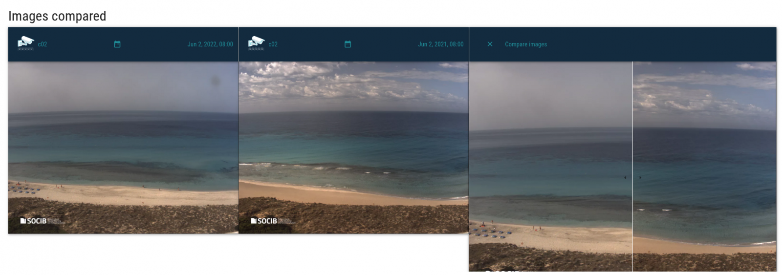
The Beach Monitoring Viewer (BEAMON Viewer) is designed for all types of users, from coastal scientists to coastal managers and the general public, having easy and advanced options to cover a wide range of users' interests. With just a few clicks, the app enables users to access the latest images of each beach monitoring station, as well as historical data, in addition to compare images or obtain image products related to a wave or weather condition (i.e. the height of the waves or the speed of the wind). In particular, the BEAMON Viewer image comparison tool allows users to quickly compare image products from different dates, enabling a wide range of analyses (i.e. morphological, sociological or environmental).
Furthermore, the Data Discovery tool offers image products related to a given wave or weather condition and enables users to explore a dataset according to their coastal knowledge or interest. Four types of image products are provided by the app: a snapshot, a time-exposure image (timex), a variance image, and an image of line sampled pixels along the surf and swash zones during image acquisition time (time-stack).
More information
The BEAMON Viewer application has been designed by SOCIB Beach Monitoring Facility in order to contribute to characterising and managing coastal systems properly. This is achieved by means of the Modular Beach Integral Monitoring System (MOBIMS) composed of a coastal video monitoring system, an Acoustic Doppler Current Profiler (ADCP), a weather station, and a programme of bathymetric and sediment sampling managed by SOCIB.


